File:DFM research teams map.png
From DFM Wiki
Revision as of 15:58, 28 September 2021 by EricThrift (talk | contribs) (Uploaded own work with UploadWizard)
Size of this preview: 800 × 434 pixels. Other resolutions: 320 × 173 pixels | 1,127 × 611 pixels.
Original file (1,127 × 611 pixels, file size: 188 KB, MIME type: image/png)
Summary
|
Description |
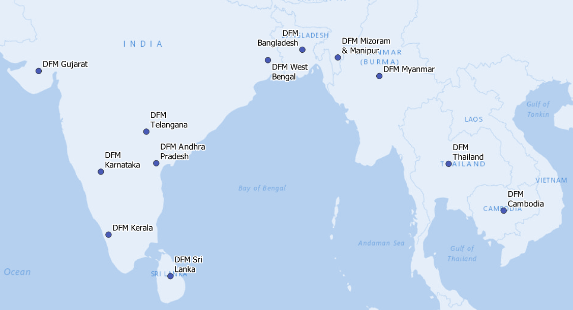
Map showing locations of DFM research teams. Generated in QGIS using ESRI Gray base layer.
|
|---|---|
|
Source |
Own work. |
|
Date |
2021-09-28 |
|
Author |
|
|
Permission |
See below.
|
Licensing
I, the copyright holder of this work, hereby publish it under the following license:
This file is licensed under the Creative Commons Attribution-Share Alike 4.0 Unported license.
File history
Click on a date/time to view the file as it appeared at that time.
| Date/Time | Thumbnail | Dimensions | User | Comment | |
|---|---|---|---|---|---|
| current | 13:30, 2 November 2021 | | 1,127 × 611 (188 KB) | EricThrift (talk | contribs) | Modified colour to match the logo colour scheme. Slightly larger label text. |
| 16:04, 28 September 2021 | 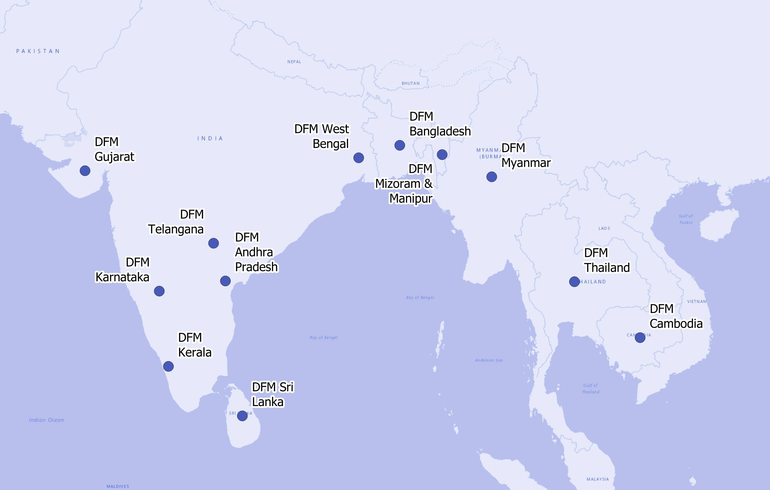 | 2,650 × 1,688 (640 KB) | EricThrift (talk | contribs) | Smaller file with tighter cropping. | |
| 15:58, 28 September 2021 | 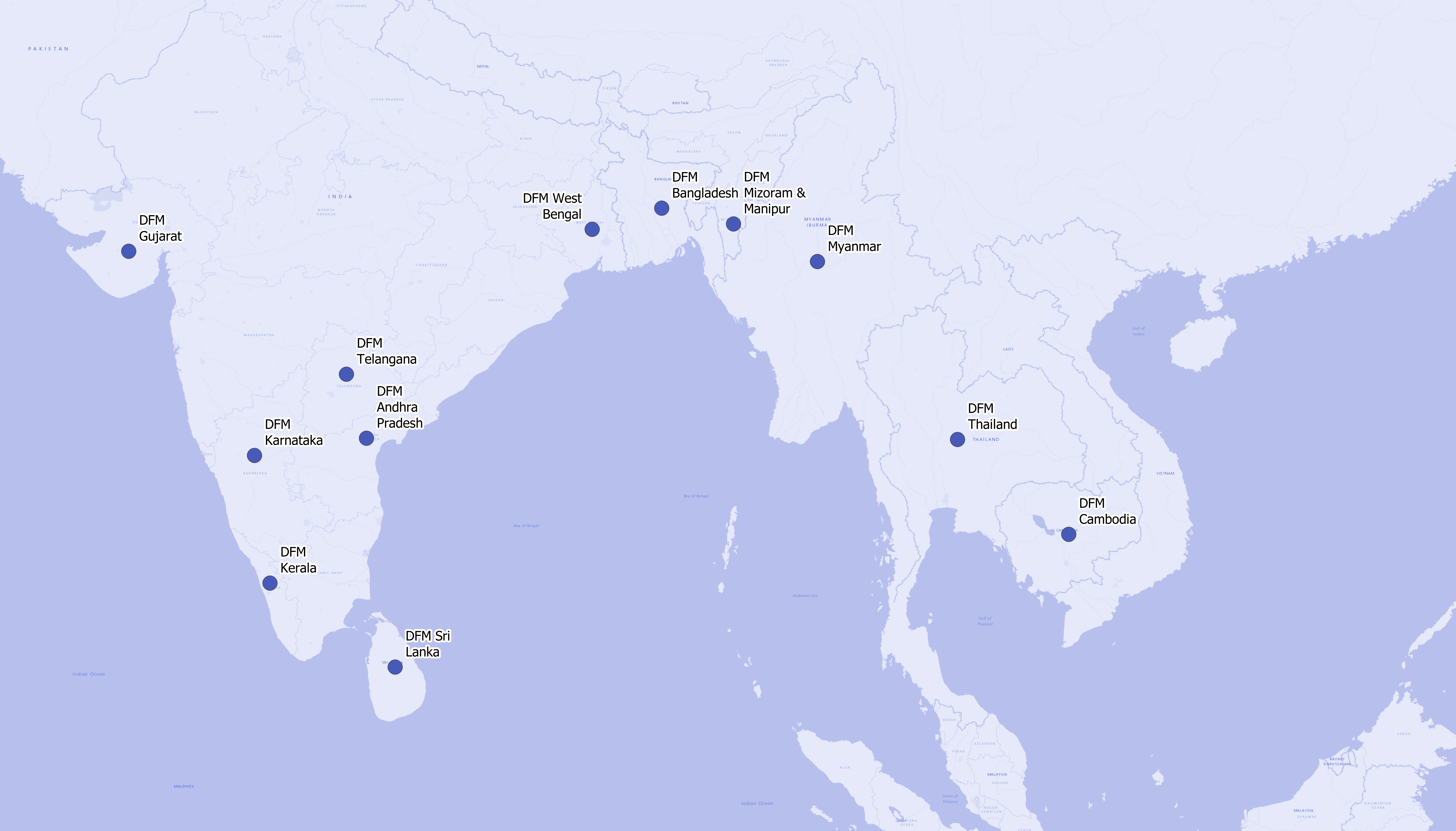 | 4,656 × 2,656 (1.92 MB) | EricThrift (talk | contribs) | Uploaded own work with UploadWizard |
You cannot overwrite this file.
File usage
The following 2 pages use this file:
